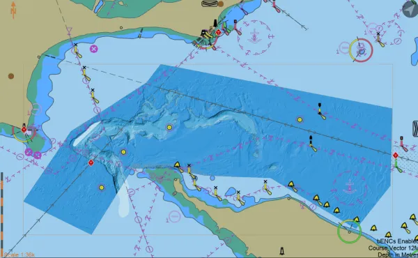
S-102 bathymetric surface product is a digital elevation model which represents the seafloor in a regular grid structure and is intended to support safe passage and precise berthing and mooring.
S-102 is designed to be more flexible and customisable than traditional bathymetric data formats, such as XYZ grids or raster images. S-102 will enhance the accuracy, consistency and interoperability of bathymetric data and will play a key role in the development of next-generation digital navigation systems and marine spatial data infrastructures.
In ECDIS, S-102 can substitute S-101 ENC depth information to provide a higher resolution and more accurate picture of the seafloor to mariners.