
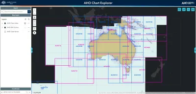
The AHO Chart Explorer is an interactive web application for finding AHO nautical products.
Use it to discover and select official paper charts, Electronic Navigational Charts (ENC), and AusENC packs through an intuitive, map-based interface.
Key features:
- Visualise ENC content: The application includes a not-for-navigation AHO ENC Online layer. This allows you to see the contents of ENC products directly on the map.
- Check chart currency: Find the latest edition and update information for products.
- View data quality: Understand the accuracy and reliability of bathymetric data through the Zone of Confidence (ZOC) layer.
- ENC Feature Search: Search for, and zoom to specific charted features.
- ENC Feature Query: Identify features and view their attributes.
- Access help: An integrated user guide is provided to help you use the application.
Official charts and safety
The AHO Chart Explorer is an interactive product discovery tool and is not for navigation.
For safe and compliant navigation, you must always use official nautical charts and publications.
AHO products can only be obtained from authorised Distribution Agents.
If you require more information, or would like to provide feedback, email AHO Communications.
Maritime Gazetteer of Australia
The Maritime Gazetteer of Australia (MGA) has been removed from the website. The AHO Chart Explorer can be used to access placename information used in Australia's official navigational charts. Please see the integrated user guide for assistance with using the application.